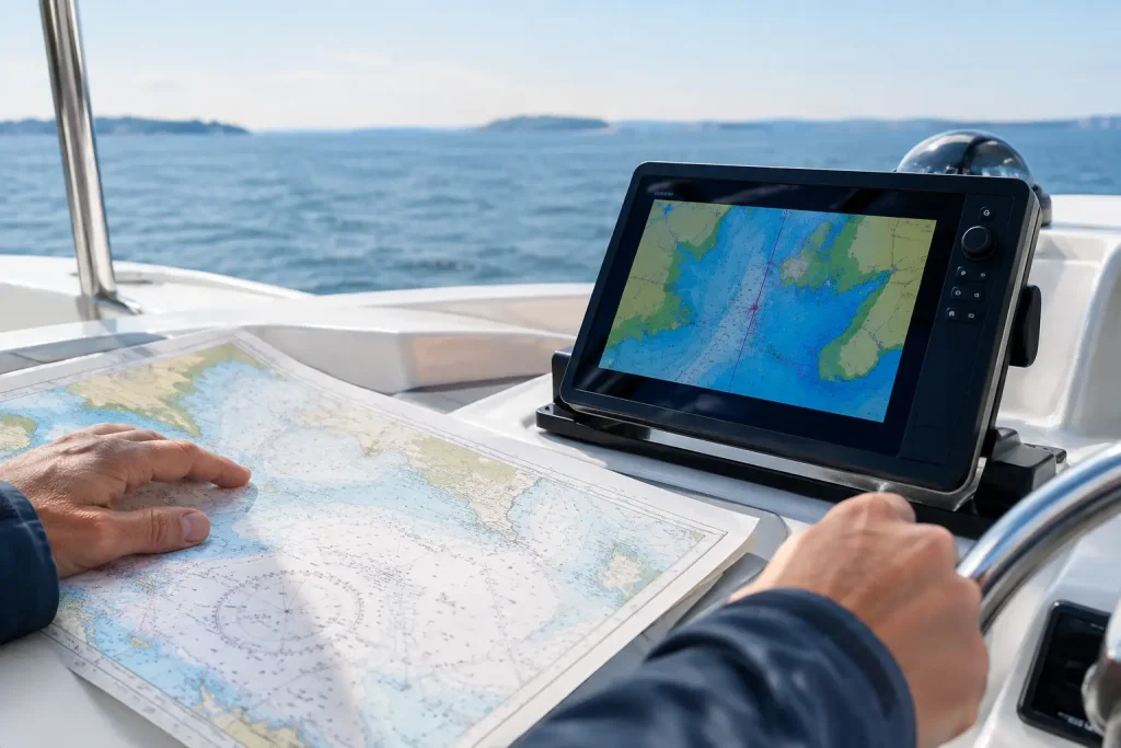
A chartplotter can place your boat on the screen with remarkable precision. But on a foggy morning near Vancouver, with tide running through a narrow pass and traffic appearing out of the gray, the real question is not whether the dot is accurate. It is whether the skipper understands the water around it. That is the heart of paper charts versus chartplotters: one is not a relic, and the other is not a substitute for judgment.
For recreational sailors, the best answer is usually not choosing one over the other. It is learning what each tool does exceptionally well, where each can mislead you, and how to keep navigating when conditions become less forgiving.
Paper Charts Versus Chartplotters: The Real Difference
A paper chart gives you the broad picture. It shows the coastline, soundings, hazards, aids to navigation, channels, tidal information, and the relationship between one area and the next. Spread across a table, it encourages a navigator to think beyond the next waypoint. You can see the escape route, the alternate anchorage, the headland that may hide a squall, and the shallow bank that makes a shortcut a poor idea.
A chartplotter gives you immediate position awareness. Connected to GPS, it can show your vessel’s course, speed, track, route, depth data, AIS targets, radar overlay, and more, depending on the equipment aboard. In reduced visibility or busy water, this can be a tremendous advantage. It reduces the time needed to answer a basic but vital question: where am I right now?
The distinction matters because navigation is more than knowing position. It is planning, monitoring, anticipating, and deciding. A sailor who only follows a magenta line may know where the boat is but still fail to notice what the current, weather, depth, or traffic is doing to the plan.
Why Paper Charts Still Matter
Paper charts require active participation. To plot a course, you must consider distance, compass direction, variation, tidal current, expected speed, and the route’s hazards. That process builds the mental model every skipper needs. You are not merely following instructions from an electronic device. You are learning to read the coast and understand how your boat will move through it.
This is particularly valuable on the BC coast, where a route that looks straightforward can be shaped by tidal gates, strong currents, narrow channels, commercial traffic, and limited visibility. A chartplotter may display a fast route, but it does not know your crew’s experience, your vessel’s handling characteristics, or whether an exposed passage remains comfortable and prudent in the forecast wind.
Paper also provides independence. Electronics can fail because of a flat battery, damaged antenna, water intrusion, failed fuse, software issue, or an incorrectly configured unit. These are not reasons to avoid chartplotters. They are reasons to carry a current paper-chart backup and know how to use it.
A paper chart is not immune to problems, of course. It can be out of date, poorly stored, hard to manage in a small cabin, and difficult to read at night or in rain. It also does not tell you your position. To use it properly, you need fixes from visual bearings, GPS coordinates transferred to the chart, radar ranges, or other available information. That takes practice, especially when the boat is moving and conditions are changing.
The skills paper charts teach
Working with paper charts develops habits that carry directly into electronic navigation. You learn to identify conspicuous landmarks, compare charted depths with the depth sounder, calculate a course to steer, estimate time of arrival, and question an unexpected result. Most importantly, you learn not to accept any single source of information without cross-checking it.
That habit is a safety margin. If the chart says deep water but the sounder suddenly shows a rapidly decreasing depth, slow down and investigate. If the GPS position seems to put you near a buoy that you cannot see, check the chart scale, visibility, range, and your assumptions. Good seamanship begins when something does not make sense.
Where Chartplotters Earn Their Place
A well-installed, current chartplotter is one of the most useful tools aboard a cruising sailboat. It excels at repetitive monitoring. During a long passage, it can show whether you are being set off course by current, how closely you are approaching a waypoint, whether a target vessel has a concerning closest point of approach, and whether your actual track is safely clear of charted hazards.
It also improves situational awareness when used with other instruments. AIS can help identify commercial vessels and their movement. Radar can reveal land, rain, and targets in poor visibility. Depth and speed data can confirm what the chart and your observations suggest. Rather than replacing traditional navigation, these tools can create a stronger picture when the skipper understands their limitations.
The limitation is that a screen can create false confidence. A chartplotter cannot guarantee that its chart data is current, that your position is accurate to the degree you assume, or that a route is appropriate for your boat. Its auto-routing feature may suggest a passage through water that is technically charted but unsuitable because of your draft, local conditions, bridge clearance, regulatory restrictions, or comfort level.
Never treat a route generated by electronics as a route that has been checked. Review every leg at an appropriate chart scale. Look for minimum depths, obstructions, tides, traffic separation schemes, cable areas, and room to maneuver. Then consider the human factors: Is the crew rested? Can everyone see well enough? Do you have a sensible bailout point if the weather changes?
Electronic navigation needs disciplined setup
Chartplotters are only as dependable as the information and settings behind them. Keep chart data updated. Confirm that the unit is set to the correct units, depth alarms, chart datum, and vessel offset where applicable. Know whether displayed depths are referenced to chart datum and how that differs from the water actually under your keel at a given tide.
Screen scale deserves special attention. Zooming too far out can hide small hazards, while zooming too far in can make it difficult to understand the larger coastal picture. A practical habit is to look at the route on a broad scale for strategic planning, then use a closer scale for pilotage. Do not let the detail of the screen cause you to lose awareness of what lies ahead.
Use Both Tools in a Practical Routine
The most capable navigators combine the strengths of both systems. Before departure, study the paper chart or a full-size chart display to understand the entire route. Mark the key hazards, turning points, tidal considerations, alternate destinations, and areas where close attention will be needed. Calculate a realistic passage plan rather than relying only on estimated arrival time from a device.
Underway, use the chartplotter to monitor your position, track, speed, and traffic. Keep your eyes outside the boat, especially in confined water. Confirm important marks visually when possible, and compare the depth sounder with expected charted depths and tide. If the plotter route and what you see outside disagree, slow down before deciding which source is wrong.
For a longer coastal passage, record position, course, speed, weather, and engine hours in a log at sensible intervals. A paper log is more than tradition. It creates a record that helps you spot changes, recover after an electronics failure, and maintain discipline during a busy day.
It is also wise to prepare for the possibility that the primary display goes dark. Carry current paper charts for your cruising area, a compass, pencils, a ruler or parallel rules, and a way to obtain an independent position. A handheld GPS or navigation app can be useful backup, provided it is charged, protected from water, and not your only plan.
The Right Choice Depends on the Sailor and the Passage
For a first-time sailor learning basic coastal navigation, paper-chart work is essential because it teaches the reasoning behind the route. For an experienced cruiser covering miles in changing weather, a chartplotter with AIS and radar integration can make watchkeeping safer and less exhausting. For most boat owners, the strongest approach is not paper or electronic navigation. It is competence with both.
This balance is central to practical seamanship training. A skipper should be able to plan a course without electronics, then use electronics intelligently once underway. They should know how to read a tide table, recognize a navigation mark, interpret a depth trend, and make a conservative decision before a minor problem becomes an emergency.
At Capt. Mac’s School of Seamanship, navigation is taught as a living skill, not a screen exercise. The goal is confidence that holds up when the wind rises, daylight fades, or the equipment does not behave as expected.
The next time you plan a cruise, let the chartplotter help you see precisely where you are. Then open the paper chart, look farther ahead, and ask the question that matters most: what is the water asking of me next?